
The following circular walks can be downloaded below

Apex Park
Berrow Beach
Berrow Beach
Easy Walk in an award winning park and recreational area. 1.25 miles / 2 km. 30 Minutes.
Apex Park is a gem with 42 acres of land including lakes, wildflowers, trails and play areas formed from former clay pits.
Berrow Beach
Berrow Beach
Berrow Beach
Easy Walk on a sandy beach. 2.3 miles / 3.5km. 90 Minutes.
This walk has fantastic open coastal views as well as shaded woodland paths.
On the shore it takes in the wreck of the Nornen, still clearly visible after running aground during a storm in 1897.
Brean Down
Berrow Beach
Brean Down
Easy to Moderate Walk. 3 miles / 4.8 km. 2 - 2.5 Hours.
This walk travels the length of Brean Down; a natural pier standing 97 mtrs high and offering stunning views across the Bristol Channel to South Wales, north to Weston-super-Mare and South to Exmoor and the Somerset Levels.
Bridgwater
Berrow Beach
Brean Down
Easy Walk. 2 miles / 3.5 km. 2 Hours
This walk is along pavements and paved pathways that explores the historic market town of Bridgwater.
Burnham-on-Sea
Burnham-on-Sea
Burnham-on-Sea
Easy Walk . 3.4 miles / 5.5 km. 1.5 - 2 Hours.
This walk takes you along pavements, sandy shore and local footpaths. Due to sections on the shore this walk is not suitable for wheels.
Dunster
Burnham-on-Sea
Burnham-on-Sea
Easy Walk. 3.5 miles / 5.5 km. 90 Minutes.
This walk is on footpaths and farmland with some sections on country lanes, pavements and paved paths. There are gates and open gateways but no stiles.
Kilton
Burnham-on-Sea
Kilton
Easy Walk . 3.4 miles / 5.5 km. 2 Hours.
This walk has historical interest as well as some wonderful views across to Dunkery Beacon on Exmoor and the Welsh Coast.
Kilve
Burnham-on-Sea
Kilton
Easy Walk. 4 miles / 6.5km. 2.5 Hours.
This walk takes you through Kilve and East Quantoxhead on the borders of the Quantock Hills with lots of geological interest, local history and fantastic views.
Lilstock
Quantocks & Coast
Quantocks & Coast
Easy Walk . 3.7 miles / 6 km. 2 Hours.
This walk explores parts of old Acland-Hood Estate, now known as the Fairfield Estate. Also taking in the beautiful, abandoned churches of St Andrews in Lilstock and St Nicholas Wayfarers in Kilton.
Quantocks & Coast
Quantocks & Coast
Quantocks & Coast
Moderate Walk. 9.5 miles / 15.5 km. 5 Hours.
This walk takes in the coastal path with stunning views across West Somerset and over the channel to Wales, and the foothills of the Quantocks.
St Audries Bay
Quantocks & Coast
St Audries Bay
Easy Walk . 1.5 miles / 2.4 km. 1.5 Hours.
This walk is tidal, so please check the tide times.
Taking in the beach with fossils dating back millions of years and home to the spectacular St Audries Bay Waterfall.
Steart Marshes
Quantocks & Coast
St Audries Bay
Easy Walk. 3 or 6.5 miles / 5 or 10.5 km. 1.5 or 3.5 Hours.
These walks offer all round views of the Poldens, Mendips, Exmoor and the Brecon Beacons, as well as providing hides and screens for keen bird watchers.
Walks for the more adventurous
Bridgwater and Taunton Canal
Bridgwater and Taunton Canal
Bridgwater and Taunton Canal
The Bridgwater and Taunton Canal was opened between Taunton and Huntworth in 1827 and extended to join the new docks at Bridgwater in 1841, making its total length fifteen and a quarter miles (24.5 kms).
Castles and Coast way
Bridgwater and Taunton Canal
Bridgwater and Taunton Canal

Easy to Moderate walk 13 Miles / 21 Km
The walk links The Coleridge Way in Nether Stowey and the England Coast Path and can be completed as a day walk or in sections which lend themselves to easier circular walks. The route is well signposted and waymarked with the Castles and Coast Way logo.
Coast Path - Somerset
Bridgwater and Taunton Canal
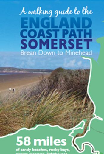
58 Miles of sandy beaches, rocky bays, nature reserves, lighthouses and historic harbours.
Crook Peak
Watchet to Washford

Moderate / Hard (steep sections) walk 3 miles.
A treck across the Mendip Hills enjoying the extraordinary 360 degree views of the North Somerset coast, the Somerset levels and across to Cheddar and Wells.
Watchet to Washford
Watchet to Washford
Watchet to Washford
Moderate walk of 7 Miles 2 - 3 Hours.
A beautiful historic circular walk.
The Mendip Way
Watchet to Washford
Watchet to Washford
Multiple small walks along the stunning Mendip Way.
Mark
Wedmore, Wetlands and Sand
Shapwick to Catcott
Moderate walk 7 Miles focussing on Mark Moor with its linear droves, rhynes and ditches that criss-cross the landscape in this part of the Avalon Marshes.
Shapwick to Catcott
Wedmore, Wetlands and Sand
Shapwick to Catcott
Moderate 6 mile walk taking in the historic villages of Shapwick and Catcott.
Wedmore, Wetlands and Sand
Wedmore, Wetlands and Sand
Moderate 4.5 Mile walk starting in the historic village of Wedmore.
The Strawberry Line

The Strawberry Line Heritage Trail is a 10 mile traffic free route through the heart of North Somerset linking the Levels to the Mendip Hills.
Mendip Hills

A guide for your walks in the Area of Outstanding Natural Beauty that is the Mendip Hills.
Brean Down Way

An 8 mile walk or cycle from Brean Down to Weston-super-Mare through beautiful nature reserves.